

Why a Paper Map Still Earns Its Place in Your Pack
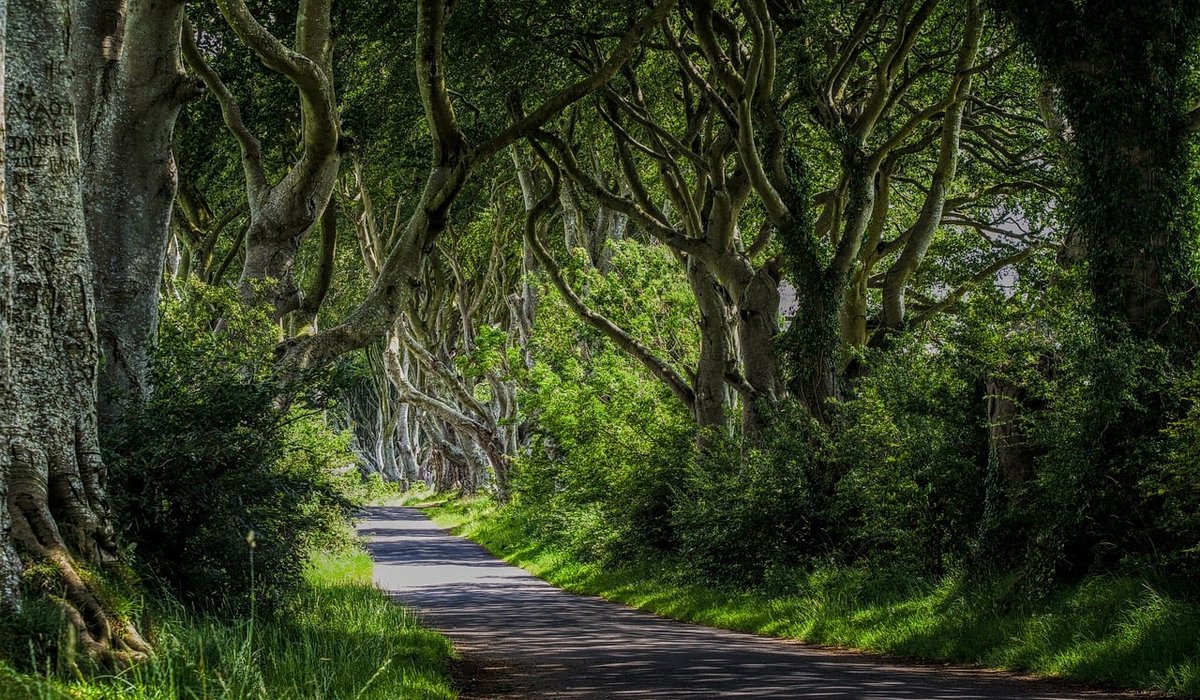
In dense woodland, phone signal vanishes, batteries drain, and a cracked screen is useless in the rain. A paper map, folded into a clear case, never lets you down. It shows the whole landscape at once: the shape of the hills, the legal lines of paths, and the pockets of access land where you can wander freely. You cannot pinch and zoom, but you can spread it on a log, trace a route with your finger, and see how the woods fit into the wider countryside. That overview is priceless when you are planning a walk or looking for a wild pitch.
Contour Lines: The Woodland's Hidden Language
Contour lines join points of equal height. On a 1:25,000 map, they are usually spaced every 5 or 10 metres. When they crowd together, the ground is steep. When they spread out, it is gentle. In woodland, this matters more than in open country because trees hide the view ahead. A tight cluster of contours around a hilltop means a lung-busting climb through bracken and brambles. A broad gap between them on a ridge means easier walking under the canopy.
Look for V-shaped contours pointing uphill – that is a valley or stream, often boggy underfoot. A U-shape pointing downhill is a spur, which usually offers drier ground. Flat areas between contours are your best bet for a level tent pitch or a rest stop. Contours also reveal where a path will dip and rise, so you can pace yourself and avoid surprise climbs.
- Tight contours: steep slopes, likely muddy and slow.
- Widely spaced contours: gentle terrain, good for easy woodland miles.
- V-shaped valleys: streams, wet ground, and natural wildlife corridors.
- Flat shelves: potential camping spots, but check for dead trees above.
Rights of Way, Access Land and Permissive Paths
In England and Wales, public rights of way are legal routes. On a paper map, they appear as coloured lines and symbols. Public footpaths are usually green dashed lines. Bridleways have a plus symbol and allow walkers, cyclists, and horse riders. Byways are open to vehicles. In Scotland, the right to roam responsibly covers most land, including many woodlands, but you must still respect privacy and farming.
Access land is shown as a pale orange or yellow wash on many maps. It comes from the Countryside and Rights of Way Act 2000 and lets you walk off-path on mapped open country, including some forests. Always check for local signs or temporary closures at access points. Permissive paths are not rights of way – the landowner allows access but can close them at any time.
- Public footpath: walk on foot only, stick to the line.
- Bridleway: walk, cycle, or ride a horse.
- Access land: wander freely, but avoid walls, crops, and nesting birds.
- Permissive path: enjoy it, but do not assume it will always be there.
Grid References and Compass Confidence
A grid reference pinpoints your location on the map. Use the grid lines: eastings run vertically, northings horizontally. The rule is simple – along the corridor, then up the stairs. For a six-figure reference, give two digits for the easting, two for the northing, then estimate tenths. For example, 123 456. Write it down before you leave and share it with someone at home.
To use a compass with your map, lay the compass edge along your intended direction of travel. Turn the bezel until the orienting arrow aligns with grid north. Then hold the compass flat and rotate your body until the red needle sits inside the orienting arrow. In woodland, use handrails – a stream, a wall, a forest track – to follow a line. Aim off deliberately to one side of your target so you know which way to turn when you hit a boundary. Magnetic declination is small in the UK, but check the map margin for the local difference.
Planning a Woodland Walk and Camp
Measure distance using the map's scale. On a 1:25,000 map, 4 centimetres equals 1 kilometre. Add time for undergrowth, mud, fallen trees, and stiles. Naismith's rule gives a baseline: allow one hour for every 5 kilometres, plus one minute for every 10 metres of ascent. In woods, add 20 to 30 per cent extra – you will be stepping over roots and ducking branches.
Identify escape routes and bail-out points: roads, car parks, bus stops, or a clear ridge line. Mark water sources, but treat all water before drinking. For camping, look for level ground away from dead trees and above flood lines. In England and Wales, wild camping is largely illegal without the landowner's permission – use campsites or ask at a farm. In Scotland, wild camping is allowed under the Land Reform Act, but not in enclosed fields or close to buildings.
- Check local bylaws for camping, fires, and overnight parking.
- Leave no trace: take everything home, bury human waste, use a stove.
- Tell someone your route, grid references, and expected return time.
- Carry a backup – a second compass, a whistle, and a headtorch.
Trusting Your Map When the Path Fades
Woodland paths can disappear under leaf litter or fresh growth. When the ground and the map disagree, trust the map and your compass. Look for subtle signs: a gap in the trees, a stone bridge, a line of older oaks that once marked a boundary. If you lose the path, stop, set your map, and take a bearing back to a known handrail. Do not thrash through undergrowth hoping to find it. A calm pause with a paper map is safer and faster than blind wandering.
Finally, remember that a map is a conversation with the landscape. The more you read its contours, rights of way, and grid lines, the more confident you become. Soon you will plan woodland walks and quiet camps with the same ease as a local forester – warm, dry, and exactly where you meant to be.



John Doe
14 January, 2022Having no content in post should have adverse..
Chauffina Carr
10 April, 2022We use these tests all time! Killer stuff!
Jim Séchen
16 July, 2022Thanks for all the comments, everyone!